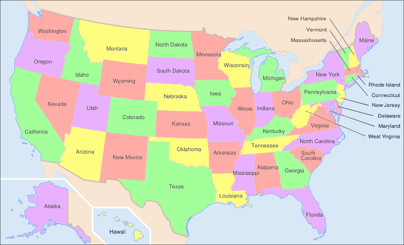
One of the most intriguing aspects of the US is the varying shapes and sizes of its states. If you've ever looked at a map, you might've pondered why Colorado and Wyoming are rectangles or why Oklahoma has a “panhandle.” Let's dive into the captivating tales of state map shapes.
Nature's Boundaries
Many of the eastern states are shaped by nature, primarily using rivers as boundaries. For instance, the Potomac River delineates a portion of Virginia and Maryland, while the Mississippi River forms natural borders for states like Louisiana, Mississippi, and Arkansas.
Historical and Political Influences
Human decisions, driven by historical and political factors, have been crucial in defining the state lines.
- West Virginia: The division between Virginia and West Virginia during the Civil War resulted from differing political beliefs and economic systems. West Virginia's shape was determined partly by the range of the Allegheny Mountains and the Ohio River, but also by those counties in Virginia that wanted to remain in the Union.
- Oklahoma's Panhandle: Texas had to surrender its northernmost territory to avoid borders with slavery-prohibiting territories. This strip was later attached to Oklahoma, resulting in its unique shape.
Territorial Adjustments
While the shapes of most states have remained consistent since their inception, some experienced tweaks:
- Missouri: The famous “Honey War” between Missouri and Iowa in the 1830s was a dispute over territory. It wasn't an actual war but got its name because of some destroyed honey trees. Eventually, a small chunk of land was given to Iowa, slightly adjusting Missouri's shape.
- Arizona and New Mexico: Originally, the two territories were one, with a vertical boundary. However, southern leaders wanted a southern transcontinental railroad route, which led to the horizontal division we see today.
A Modern Way to Learn State Shapes: Introducing “States”
With vibrant flashcards and challenging quizzes, States offers an interactive way to learn state map shapes. Dive deep into the US map, one state at a time, and become a geography whiz.